
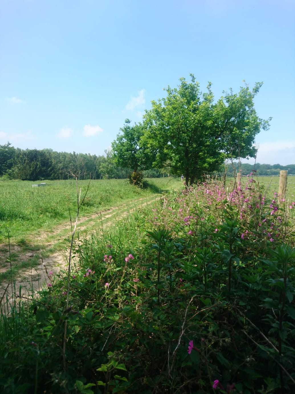

Natalie Leal takes a circular walk through the surrounding farmland and forest and enjoys far-reaching views out to sea. This short route is perfect for a summer weekend stroll with a picnic along the way.
Pack a picnic and head to Madehurst. The lush countryside and shady woodland surrounding the tiny West Sussex village makes you feel like you’re a million miles away from civilisation.
1.
Tucked away in a valley to the north-west of Arundel in West Sussex is the South Downs village of Madehurst. The village contains only a smattering of houses and a small church, St Mary Magdalene which was founded in the twelfth century.
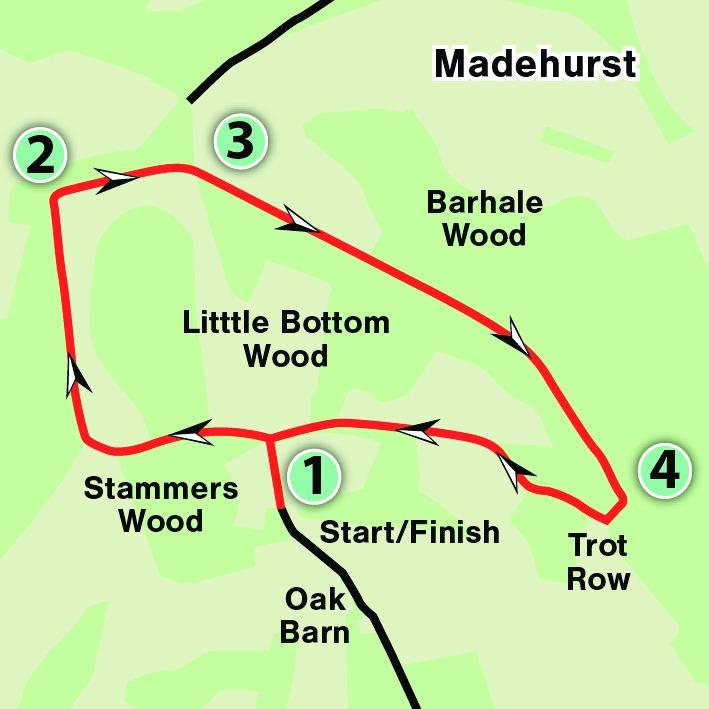
The walk begins at the end of a long lane off the road through Madehurst. Park up at the end of the lane in the layby close to a house named Stammers and walk straight ahead along the bridleway as it leads gently uphill.
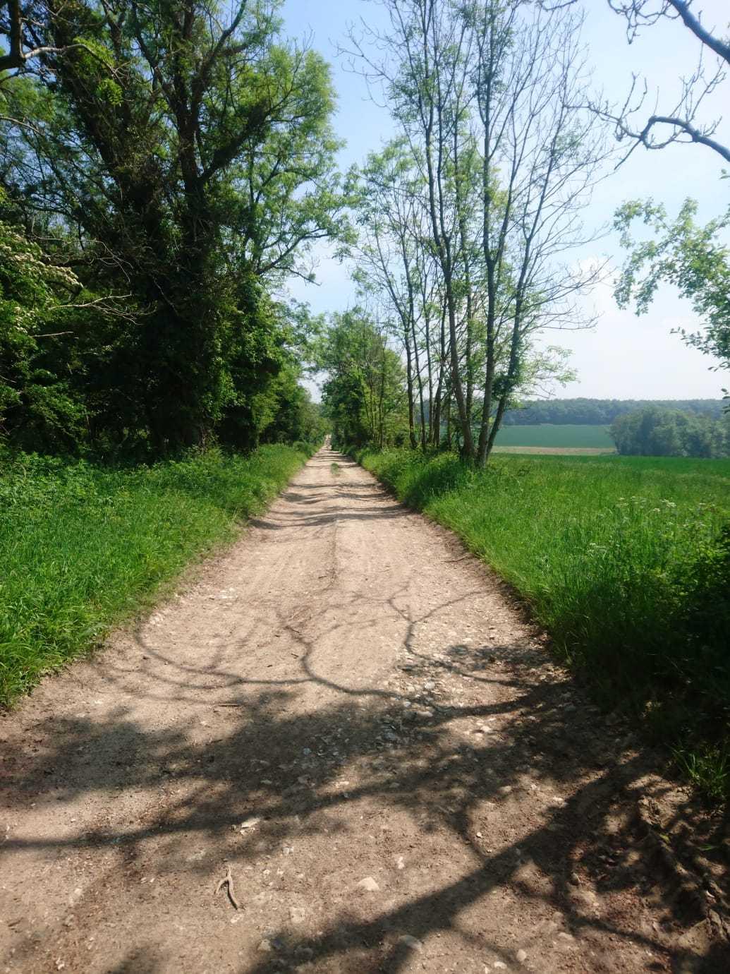
When you reach a cross roads, turn left and follow the bridleway along the left hand side of a field. At the end of the field continue straight ahead through a lush valley with tall trees on either side. When you reach the fork in the path, take the left-hand route through the trees. After coming out of the tunnel of trees turn right at the field, then turn left and head back into the woods.
Shortly after, turn right at the T-junction and follow the bridleway as it climbs steadily to Gumber Corner ignoring any turnings off to the left on the way.
2.
When you reach the T-junction at Gumber Corner go right and follow the wide bridleway for approximately half a mile. There are far-reaching and beautiful views over the South Downs and out to sea along this stretch. There are also a couple of well placed benches for you to stop and appreciate the scenery. Ignore any turnings off to the left and keep walking until you reach a cross-roads with a chunky wooden bench on the corner (this makes for a perfect picnic spot).
3.
Go straight ahead at the cross-roads (for a shorter route you can take the right-hand path here which takes you back down into Madehurst). As you walk straight ahead there is an old Neolithic enclosure to your left. There is a long tradition of farming in the South Downs dating back thousands of years. This history has left its marks on the landscape however all that remains to be seen here are a few lumps and bumps in the field.
Keep on the Denture and walk into Houghton Forest, continuing straight ahead on the public bridleway through the mixed woodland, ignoring any turnings for just over one mile.
4.
After around a mile walking through the forest you will come to a signed path leading off to the right along a grassy track. Take this and when you reach a field keep to the path on the right. On a clear day there are more great views over the hills and beyond to the coast from the corner of the field and this spot makes for another lovely place to stop for a picnic.
When you emerge from the woods follow the bridleway through the middle of the large field before heading back into the woods again. At the cross roads turn left and walk downhill, back to the start point of your walk.
The Essentials
Distance/Time: A circular walk of three miles taking around two hours.
By car: Take the road signed for Madehurst off the A29 between Slindon and Whiteways. Take the small turning off to Stammers and there is roadside parking in a layby at the bottom of the lane. Postcode: BN18 0NT. Grid Ref: SU 97678 11519.
By public transport: Nearest rail station is Arundel. There is very limited public transport to Madehurst. Walkers are advised to travel by car.
What’s Underfoot: The whole route is undertaken on bridleways. Some gentle climbs during the first half, then it’s all downhill for the second half. No stiles. Mostly well-surfaced bridleways however some areas can become boggy after periods of rain.
Thirsty work: There are no pubs, shops or restaurants on the route itself however The Spur Country Pub and Restaurant or the George and Dragon at Houghton are both a short drive away from the start/end point of the walk. Picnics advisable.
So you don’t get lost: OS Explorer map 121, plus a compass.


Comments: Our rules
We want our comments to be a lively and valuable part of our community - a place where readers can debate and engage with the most important local issues. The ability to comment on our stories is a privilege, not a right, however, and that privilege may be withdrawn if it is abused or misused.
Please report any comments that break our rules.
Read the rules here