
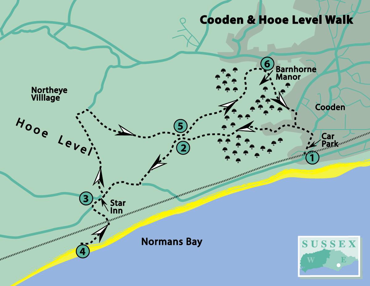
1 - If arriving by train, from the station exit turn left along Cooden Sea Road; or if starting from The Gorses car park, go back to Cooden Sea Road and turn right.
A few paces past Cooden Beach Golf Course entrance on the left, turn left into Clavering Way. Go to the end of this road and turn left at a fingerpost, by a thatched house.
In about 70 yards, turn right over a stile and cross the golf course (taking care to avoid flying golf balls!) aiming for a gap in the hedge by the left-hand white marker post of several seen ahead. Nearer the point, a hidden footpath sign may be seen.
Follow the track between woodland and, at the next marker post, cross the next section of golf course to another fingerpost. Cross to yet another fingerpost, then bear right and follow the right-hand edge of the golf course, passing by a lone tree.
Just past hole number 7, turn right at a fingerpost to leave the golf course. Follow the footpath ahead and cross a substantial footbridge.
2 - If desiring a really short walk, there is now the option to turn right for a few paces and pick up the route at point 5 (although there is no official link between these footpaths).
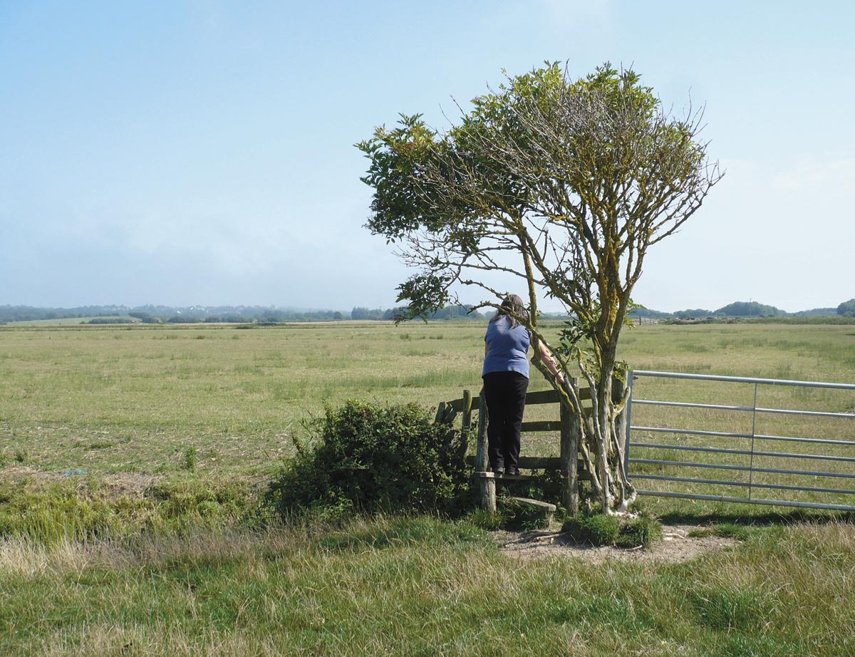
Otherwise, turn left and through a gate by a broken stile. Continue along the left-hand field edge for about 175 yards and then go over a footbridge to the right of a gate.
Bear diagonally right across the next field to a yellow post on the opposite side of the field – this may not be visible until part-way across. Now follow the right-hand field edge to cross a stile.
Turn right along a minor road (although beware of traffic – it is quite well used). Ignore a footpath on the right and cross over a river bridge with brick parapets, continuing along the road.
Before the next bridge, stop to look at a Smuggling Trail information board, in front of The Star Inn. This was a favourite haunt for smugglers until the early 19th century.
3 - Here there are two options: for those desiring to go the extra mile, continue past The Star for just over a 100 yards and turn left over a stile.
Follow the river, go over another stile and then through a kissing-gate to cross the railway line with care. Go through another kissing-gate and turn right along a footpath which leads on to a road and continue direction (south-west).
4 - At a T-junction there are public toilets on the left and access to the sea shore at Normans Bay. From here, retrace the route to The Star Inn.
For the shorter option, follow the footpath to the right of The Star car park. Go over a stile and then bear right across the field ahead and over a stile by a gate. Follow the right-hand field edge and through a gateway by a broken stile.
Continue ahead to go through two farm gates and cross a wide farm bridge. Bear left towards a yellow post and over the adjacent footbridge. Bear left again towards another yellow post and through two farm gates.
Look to the left over a farm bridge but do not cross. The rising ground here is the site of the lost medieval village of Northeye. In those days it would have been an island surrounded by flooded marshland. In this area, names ending in “ey” or “eye” usually signify an island.
Now turn right, in the opposite direction (north-east) along a track for about 150 yards. Just before a fingerpost, turn right and over a stile. Follow the right-hand ditch, known as Crooked Ditch for a reason which will become obvious, for about three-quarters of a mile, passing a footbridge on the right along the way.
5 - Just a short distance from the footbridge crossed on the outward route (point 2), turn left over a brick bridge with iron railings, through a gate and over a stile. Continue ahead, following the line of overhead wires.
Go through a gate, bearing diagonally right across the next field and over a footbridge. Continue uphill and then downhill on a wide grass path.
At the bottom, go over a culvert and turn left along a track. (The official route is over a footbridge which is overgrown and hidden in bushes to the left). Continue uphill, bearing right through a gate.
6 - Follow the track ahead to go past Barnhorne Manor on the left. Notice the modern additions to this old building. This should not be confused with Barnhorn Manor which lies to the west. Why there are two with such similar names appears to be lost in the mists of time.
Go through gates ahead, and then in a few paces, turn right through a wooden door into a caravan park. Follow the path ahead between fences and turn left at the bottom, continuing downhill to cross a stile.
Cross the field and go over a footbridge, bearing right on a path through woodland. Go over a stile at the end and turn left. Follow the woodland and field edge to cross another stile.
Turn right on a track and right again on a road. At the T-junction, turn left into Clavering Way and retrace the route to the car park or station.
Click here for a full-sized map of the Burwash walk
Distance/Time: Five and a half miles/two and a half hours, plus an extra mile if going to Normans Bay (point 4)
By Car: Use small car park (free) at The Gorses (east of Cooden Sea Road, B2182, near Cooden Station). If full, on-street parking is permitted
By Public Transport: Trains to Cooden (on the Coastway line from Brighton, Eastbourne and Hastings). Local buses only from Bexhill. Timetable information from Traveline: 0871 200 2233 or www.traveline.info
What’s underfoot: Mostly level field paths, which may be muddy, if wet, and minor roads
Thirsty Work: Cooden Beach Hotel (adjacent to Cooden Station) and The Star Inn (point 3), near Normans Bay
So you don’t get lost: OS Explorer 124 or Landranger 199. A compass would be useful for general direction


Comments: Our rules
We want our comments to be a lively and valuable part of our community - a place where readers can debate and engage with the most important local issues. The ability to comment on our stories is a privilege, not a right, however, and that privilege may be withdrawn if it is abused or misused.
Please report any comments that break our rules.
Read the rules here