
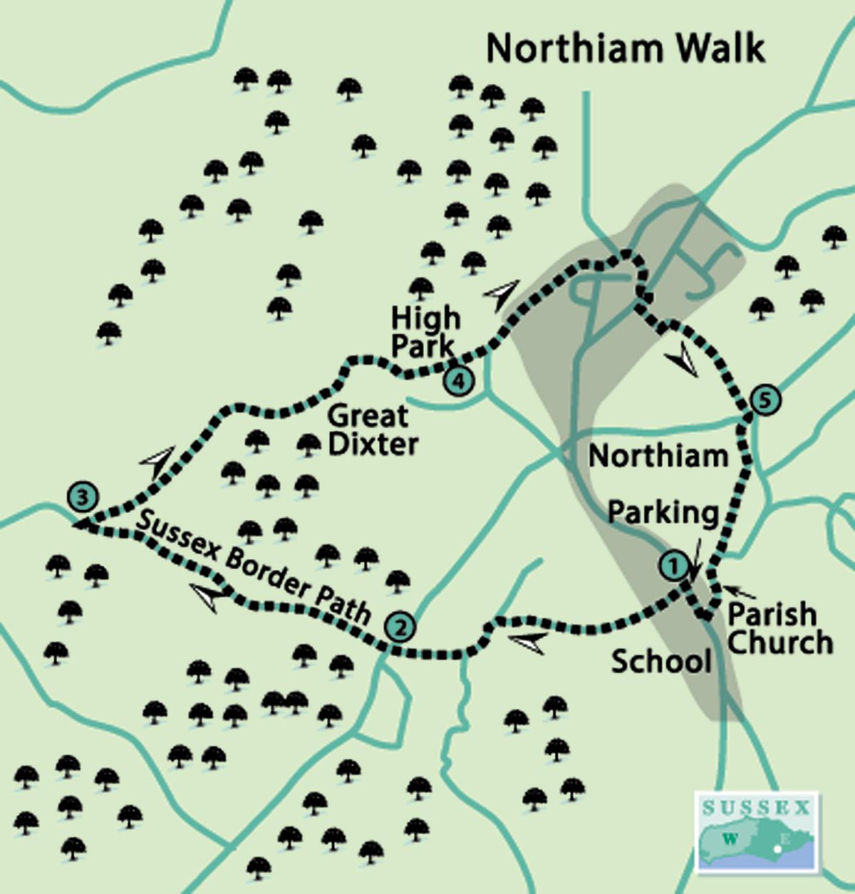
1 - Leave the car park near the doctors’ surgery to Main Street and cross to a Sussex Border Path (SBP) sign. For bus users, it is 250 yards north of the village school.
Go down the gravel drive and around to the right, then follow the left-hand field edge and go through a narrow wood. Continue along the right-hand field edge, then ahead, as indicated by a waymark, to another.
Turn left downhill towards a fingerpost, through a gap in the hedge to continue on the SBP. (This closely follows the inland Sussex border for nearly 150 miles.) Follow the footpath ahead to another fingerpost, then go over a stile, continuing down to the road.
2 - Cross and go over a stile opposite, following the SBP along the valley for about half a mile, going over two more stiles and footbridges. After passing through a narrow wood, continue for a further 150 yards across the next field. Then turn right to leave the SBP.
3 - Go over a footbridge, then uphill in a north-easterly direction across a field. Cross a short footbridge and squeeze stile, then bear right in an easterly direction uphill to cross another stile.
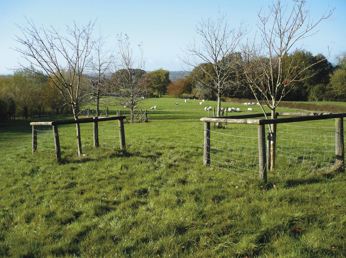
Now follow the right-hand field edge, with Great Dixter (made famous by gardener Christopher Lloyd) on the right.
Go through a plantation of young trees and over a stile to the left of a mature oak. Bear right along a track with a barn on the left, and then follow a footpath on the left-hand side of the driveway.
4 - At the road, bear left along High Park and then ahead into Dixter Lane for a quarter of a mile. Pass Crockers Lane (left) and a housing estate (right) then, in about 100 yards, turn right by a waymark through a twitten.
Go to the right of a pond, where there are seats – a good place for a rest or picnic. Then bear left, through a gate to the main road.
Turn right and, in a few paces, cross the road into The Paddock to the left of a green. At a T-junction turn left then, in a few paces, right through a kissing-gate into a wood. Follow the path downhill, over a footbridge, then uphill across fields, by the left of an old house, to a road. Note the unusual stone stile and gate.
5 - Cross, and go through a gate opposite, then through fields and three more gates to another road. Turn left then immediately right into Church Lane to visit the parish church of St Mary’s.
Continue along Church Lane in a southerly direction and turn right at the Village Green; note the plaque on a very old tree. Go downhill to return to Main Street, turning right for the car park or left for the bus stop.
Distance/Time: Three and a half miles/one and three-quarter hours
By Car: Public car park (free) off Main Street, just north of Northiam Village Green
By Public Transport: Buses (341) from Hastings and Tenterden to Northiam, alight at the primary school. Timetable information from Traveline: call 0871 200 2233 or visit www.traveline.info
What’s underfoot: Easy country paths which may be muddy, if wet; also short distances on minor roads
Thirsty Work: The Muddy Duck, Main Street, Northiam (near start/finish)
So you don’t get lost: OS Explorer 125 and Landranger 199; also a compass for general direction


Comments: Our rules
We want our comments to be a lively and valuable part of our community - a place where readers can debate and engage with the most important local issues. The ability to comment on our stories is a privilege, not a right, however, and that privilege may be withdrawn if it is abused or misused.
Please report any comments that break our rules.
Read the rules here