
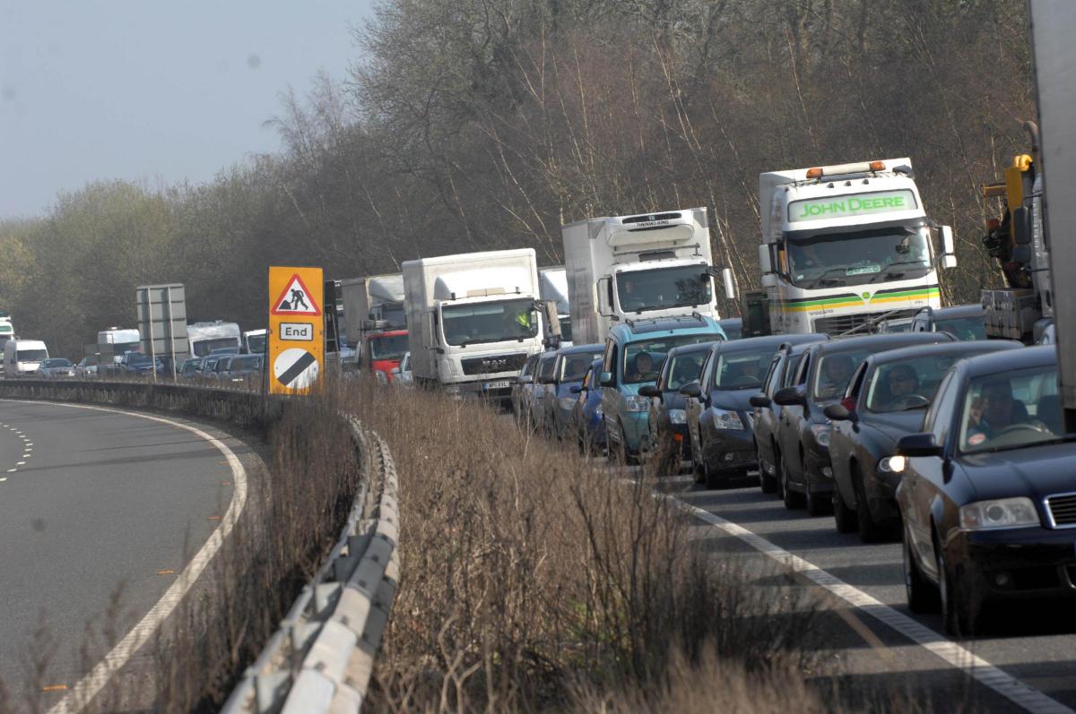
A CAMPAIGN group has said potential routes for a bypass would mean the "death" of an ancient village.
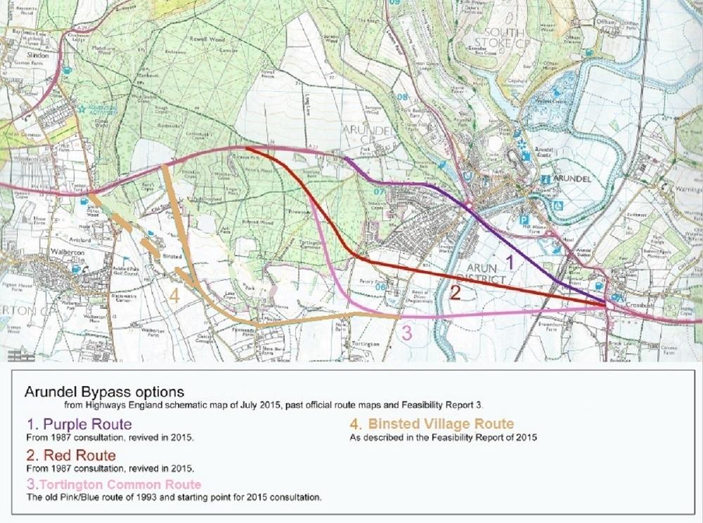
Maps showing suggestions for an A27 bypass around Arundel depict the nearby village of Binsted flanked east and west by two possible routes.
The Arundel Bypass Neighbourhood Committee (ABNC) has said the two routes would devastate the village of Binsted and divide or destroy National Park woodland.
Emma Tristram, a villager and committee member, said: “Both versions of the route would destroy a beautiful, historic landscape.
“Both would damage Binsted Woods – one by cutting them in two, the other by destruction of some of the best parts of the woods near the junction.”
Walberton Parish Council has written to Highways England asking for the Binsted route to be removed from the options for consideration.
Mrs Tristram added: “This route would mean the death of Binsted village. Long and damaging new bypasses through or near the National Park have been rejected at Chichester and Worthing. The same should happen at Arundel."
She said the Binsted route would end an annual Strawberry Fair, which raises funds for Binsted’s 12th-century church, and affect businesses such as Church Farm, the Black Horse pub, Bee Bee Kennels, craft courses in Binsted Woods, a healing centre at Mill Ball and Binsted Nursery’s propagation site.
ABNC obtained the route maps through a Freedom of Information request.
The group claims Highways England has been cagey about the exact routes it was considering, giving only verbal descriptions in its A27 Feasibility Study Reports.
Villagers believe the Binsted route option was chosen in an unsuccessful attempt to avoid the National Park.
Other options include two routes initially mooted in 1987 as well as a longer route through Tortington Common proposed in 1993. Depending on the length of the bypass, the cost ranges between £100 million and £250 million.
Highways England project manager Abi Oluwande said: “We are committed to building a new dual carriageway bypass at Arundel to link together the two existing dual carriageway sections of the road.
"These maps date back to previous studies from 12 years ago. Our starting point was the previous preferred route and we are working with the National Park Authority and local councils on this and alternative options.
"We will be reporting our findings in due course and it would be inappropriate to speculate at this stage.”
The current Options Identification Stage is due to end in November with the chosen options presented at a public consultation in spring 2017.


Comments: Our rules
We want our comments to be a lively and valuable part of our community - a place where readers can debate and engage with the most important local issues. The ability to comment on our stories is a privilege, not a right, however, and that privilege may be withdrawn if it is abused or misused.
Please report any comments that break our rules.
Read the rules hereLast Updated:
Report this comment Cancel