
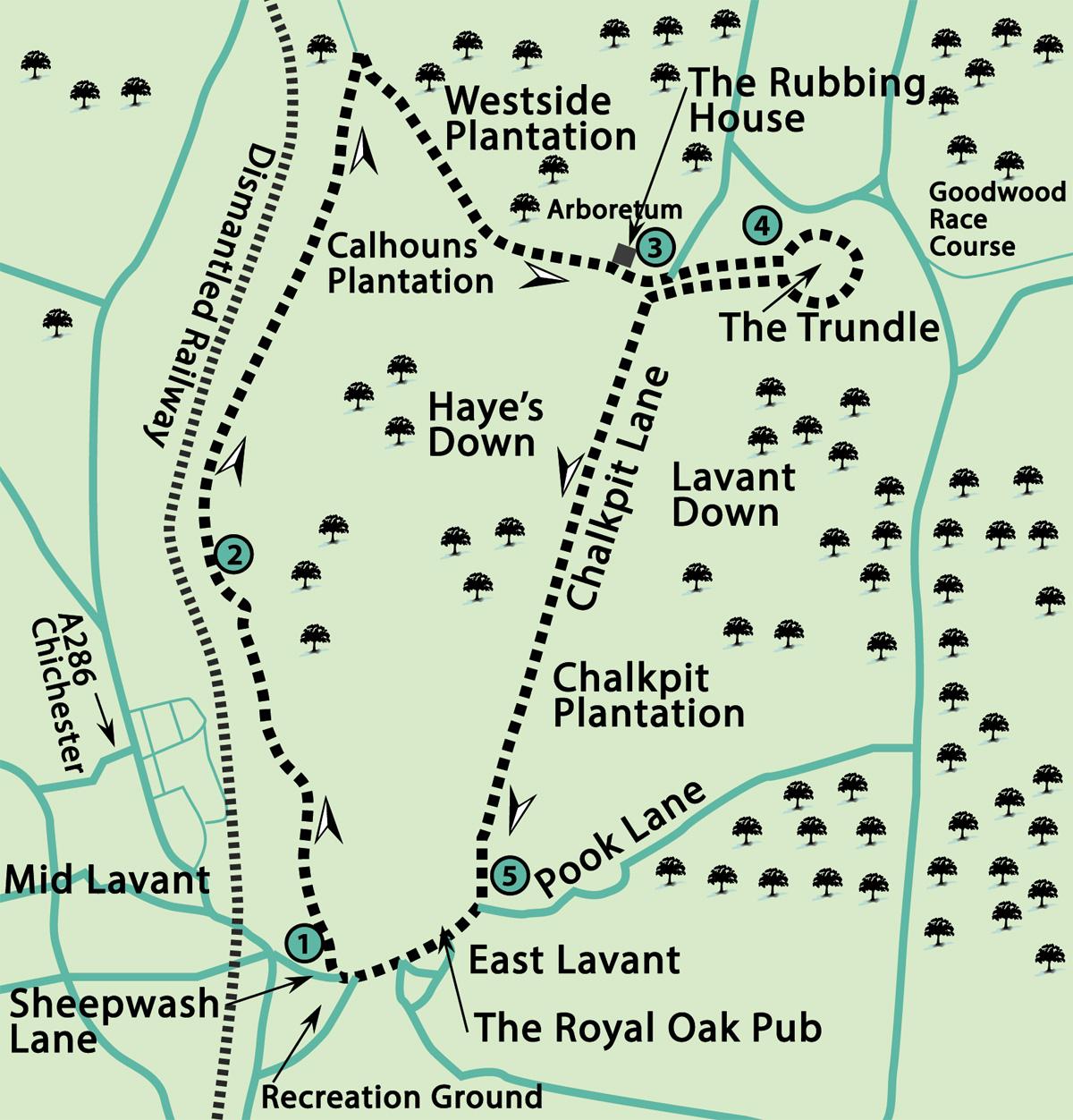
1 - From Sheepwash Lane, on the north side of the village green and recreation ground in East Lavant, locate the northbound bridleway that crosses on a bridge, above the (usually) dried-up River Lavant and follow the northbound track.
For the first few hundred yards the track is bordered by hedgerow, taking twists and turns between arable and pasture meadows for nearly a mile, the village of Mid Lavant is away to the left.
Also on the left the occasionally mighty and roaring River Lavant (the last major flood surge was in 2000) flows down the valley. Having risen at East Dean, the river passes through the Downland villages of Charlton, Singleton and West Dean, on its way around and beneath, and in its turbulent past through Chichester to the sea.
The bridleway continues north, passing through gates and hedgerows and, after nearly a mile, a water pumping station can be seen, away to the left.
Pass by a green monitoring cabin which is on the right of the bridleway, bearing very slightly right, and continuing ahead through a hedge opening. There are views off to the left towards Bow Hill and Kingley Vale, places that we have visited on previous Argus walks. As the path rises above the valley floor it enters a hedgerow tunnel, keeping direction.
When William Cobbett rode this way in 1823 on one of his Rural Rides, taking a journey from Petworth, via Singleton, into Hampshire, he noted, with approval, the quality of the farmed land and crops, there being good corn and wheat, fine Swedish turnips and walnuts. He was probably commenting on the more level landscape in the valley and that gently contouring to the west. He no doubt approved of the labours of local farm workers, whom he affectionately referred to in his writings as his “chopsticks”.
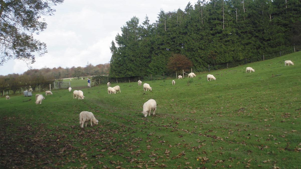
2 - Continue on the bridleway and on coming to a gate and four-way junction, after a further half a mile, with the steep grazing pasture of Haye’s Down rising on the right, keep direction, taking none of the turnings.
After a further three quarters of a mile, having passed through bridle gates, the track draws alongside a copse on the left and rises slightly towards the prominent flint wall ahead and a crossing bridleway.
Turn right up the hill, with the heavily wooded Westside Plantation, part of the West Dean Estate, over the wall on the left. Views open up down the Lavant valley to Chichester and the coast as the path climbs the hillside.
The well-graded bridleway begins to level as it approaches Calhoun’s Plantation and then follows a gentler gradient through woodland for half a mile, with the flint wall giving way to the fenced Arboretum enclosure of the West Dean Estate.
On clearing the tree cover, the track heads eastward, passing by an isolated and distinctive villa, called the Rubbing House, and continuing through a stand of trees to arrive beside a surfaced track and a small car park.
3 - From the seven-direction finger post on the opposite bank locate and follow the rising flinty track signed for The Trundle and pass through a gate. Ignore a right turning as you ascend St Roches Hill.
The track climbs for about 400 yards to arrive at a breach in the hilltop embankment. The hill has two names, the more familiar being The Trundle, and the circular embankment is the remaining part of an 3000 year old enclosure. Earlier evidence of a 6000-year-old causewayed enclosure also exists within the ramparts.
A 15th century chapel also stood on the hill, followed later by a windmill and a beacon site. There was a monitoring station in the Second World War to support the nearby Tangmere fighter airfield and now the very prominent communication masts.
You now have a choice – a clockwise or anti-clockwise walk around the ramparts, to finish back at the starting point – that choice is yours. The most obvious features from our 676 foot ascent are the far-reaching views to all points of the compass – the coast, the South Downs, the Isle of Wight, the villages and coastal towns and the prominent spire of Chichester cathedral.
As you circumnavigate the hilltop, take a peek down to Goodwood racecourse with its winding track and inverted pleasure domes. The lower slopes of the hill offer a free view of the winning post. A trip to the hilltop trig point will be the destination for a summit photograph; without doubt The Trundle offers one of the finest viewpoints in Sussex.
4 - Having arrived back at your starting point on the ramparts, descend to the wooden bridle gate and head downhill to the car park.
Turn left, passing the surfaced parking area, and follow Chalkpit Lane, the wide southward descending, chalky track, with a steep coombe and Lavant Down on the left.
The track descends for one and a half miles following a straight line, but be aware that the chalky and, in places, deeply-rutted path can be slippery when wet. The path leaves the open Downland and soon becomes a wide, hedge-lined track.
On drawing alongside Chalkpit Plantation, the former excavations being surrounded by trees, the track begins to level off and the final stretch of about half a mile arrives at Pook Lane.
5 - Turn right through the village of East Lavant, separated from its sister villages of Mid and West Lavant by the floodplain of the River Lavant. Keep to the village street, passing, or maybe not passing, The Royal Oak pub.
Keep heading west between the village houses and farm buildings and then the entrance gate to St Mary’s Church. Continue on the lane, descending to a road junction and take the right branch into Sheepwash Lane and our starting point.
- Distance/Time: Six-and-a-quarter miles taking three hours
- By Car: East Lavant is east off the A286, just before Mid Lavant, if travelling from the south. Follow minor road towards village, in a quarter of a mile, with recreation ground on left, turn left on to Sheepwash Lane for on-street parking. Start point GR SU860084.
- By Public Transport: Stagecoach South service No. 60 from Chichester stops at Mid Lavant, close to The Earl Of March pub, walk north to Sheepwash Lane, turn right to the start of the walk in 250 yards. Bus and train services connect to Chichester. Travel details from www.traveline.info, call 0871 2002233
- What’s underfoot: Downland walking on bridleways, from river valley to hilltops. Bridleways with gates, a few narrower muddy sections, no stiles and a climb on a well-graded track. Take care on chalky descent track. Possible with a baby backpack. Just about possible with an off-road baby buggy.
- Thirsty Work: The Royal Oak pub In East Lavant
- So you don’t get lost: OS Explorer Map 120, plus a compass for general direction
Click here for a full-sized map of the East Lavant circular walk


Comments: Our rules
We want our comments to be a lively and valuable part of our community - a place where readers can debate and engage with the most important local issues. The ability to comment on our stories is a privilege, not a right, however, and that privilege may be withdrawn if it is abused or misused.
Please report any comments that break our rules.
Read the rules here