

This shorter walk by Eddie Start has some climbs for excitement, some good views for the senses, a refreshment stop for an objective and you can get to it on the bus.
1 - From the bus stop, walk in front of the Devil’s Dyke Inn to the far, eastern side of the car parks and a footpath sign, beside the copse. Turn left from the sign, crossing a bank and descending the Downland slope. Head towards a fence, going left through a kissing gate. Descend a few paces and turn right along the balcony path, across the scarp. The undulating path comes to a forked junction after about 300 yards. Take the left option, indicated by a stubby marker post. On coming to coppice, descend on rustic steps, twisting and turning on slippery treads to the bottom of the hill. From the National Trust sign turn left to Poynings.
2 - Turn right along the village street, climbing left to a roadside path, after the Royal Oak. Follow the raised path to the bottom of the hill, then climb to a shelter, opposite the church. Cross the road junction into Manor Farm, passing barns, to a stile. Climb the steep bank ahead to the roadside in 200 yards. Turn right down the road, crossing left on to a bridleway in 150 yards.
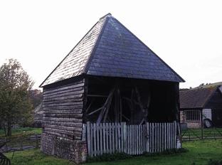
Follow the bridleway for 150 yards, taking a left branch on to a rising footpath. Climb to a lay-by viewing point, descending half-right, passing a seat, to a track. Turn left to a fence-opening in 75 yards. Continue, keeping right, for 125 yards; as the path levels-off, locate, through bushes on the left, a bridleway sign on the roadside, opposite. Cross the road, turning right on an elevated path to Saddlescombe Farm. Just after the first barn on the right, turn right into the farmyard; The Hiker’s Rest is on the right, in the walled enclosure.
3 - Turn right on leaving the tea-stop, then right again, leaving the National Trust site. Walk to the roadside, crossing with care and turning left. Head for the South Downs Way signs, passing through a gate and climbing to a right turn in 50 yards. Follow the obvious wide path across a sloping meadow, heading for Downland scrub. The path levels off after a few hundred yards, passing through a gate, close to the top of the hill. In a short distance at a junction of paths (note a mast 100 yards left), take the right grassy track, passing around the top of the diabolical ditch. Follow any of the paths around the top of the valley, climbing to a car park behind the hilltop pub.
- Distance/Time: Two-and-a-half miles taking one-and-a-quarter hours, but make sure you add on time for tea.
- By Car: Not on the bus then? You can pay and display at Devil’s Dyke car park. Start point Grid Ref TQ258110.
- By Public Transport: The No 77 bus, which leaves hourly on Sundays and Public Holidays from Brighton Pier, Churchill Square and Brighton Station. For more details call 01273 292480 or visit www.traveline.info or call 0871 2002233.
- What’s underfoot: Some steep, slippery descents and a few, shorter, heavy-breathing ascents – a short walk for a sinew-stimulating challenge. Be very careful with a baby backpack; don’t even think about it with a baby buggy.
- Thirsty Work: The Hikers Rest in the farm buildings at Saddlescombe is open weekdays and weekends, closed Wednesdays. A great place to visit, you could even just stop off for tea and forget the walk!
- So you don’t get lost: OS Explorer 122, plus a compass for general direction.


Comments: Our rules
We want our comments to be a lively and valuable part of our community - a place where readers can debate and engage with the most important local issues. The ability to comment on our stories is a privilege, not a right, however, and that privilege may be withdrawn if it is abused or misused.
Please report any comments that break our rules.
Read the rules here