
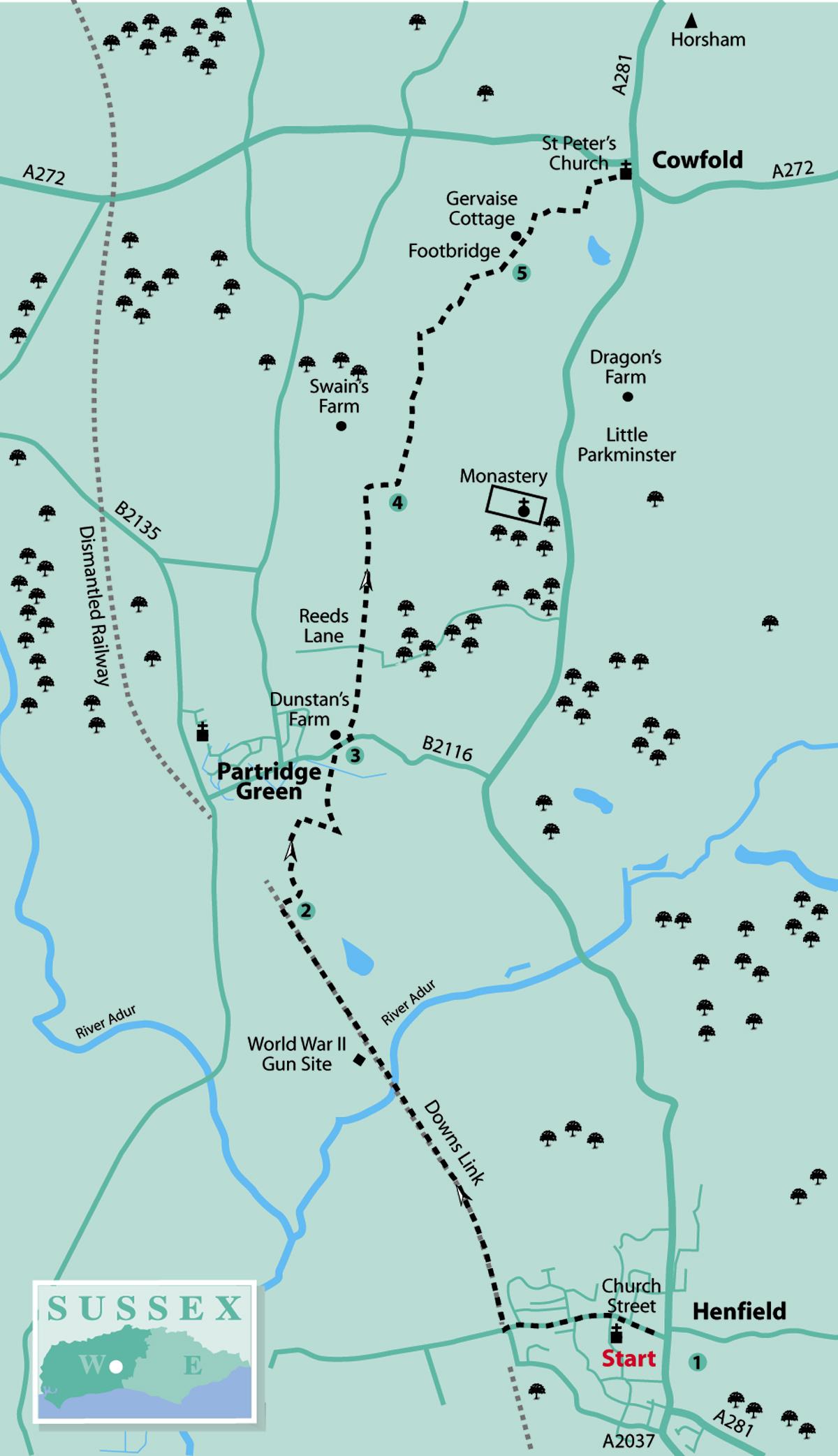
1 - If arriving by bus, walk north along Henfield High Street and turn left into Church Street, keeping a westerly direction to where the road changes to Upper Station Road. Continue ahead to finally arrive beside the Cat And Canary pub.
Just beyond the pub is a small car park, cross right over this and descend the path on the Downs Link, a 37-mile bridleway and footpath, formerly a railway, linking the coast to the North Downs. This part of our walk will take us to Partridge Green, from where we head off on other trails in our trek to the county border.
Head north on the wide track, at first in a cutting, following the line of the former permanent way – ignore any of the side turnings. On clearing the cutting, the path sits atop an embankment, with bordering scrub, keeping to the level of the former track, and after nearly a mile arrives at Betley Bridge. The bridge crosses over the confluence of watercourses that make up the Eastern River Adur. The river joins up further downstream with its western partner and heads towards Shoreham.
On clearing the bordering scrub the track keeps direction across open country, passing right of a Second World War gun emplacement. Continue to a gate and on to the way ahead, which is bordered by hedgerow, to a sharp left turning on the Downs Link in about half a mile – do not take this.
2 - Turn right on a signed footpath that in 125 yards bears left and in a further 100 yards passes to the right of a water treatment plant. The path continues through scrub, bearing slightly right, crosses a plank bridge, then a footbridge and comes to a three-way path sign at a field edge.
Turn left up the field to the top corner and there turn right (an alternative path going half-right across the field from the sign is possible but is difficult to locate). Follow the left edge of the field for 250 yards, pass through a hedge opening, cross a stile, take a few paces left and then turn quarter-left across a meadow.
In 200 yards, at the edge of a recreation field, walk ahead along the right edge of the field, passing right of tennis courts and a skateboard ramp. Skirt right around a pond and climb to the roadside.
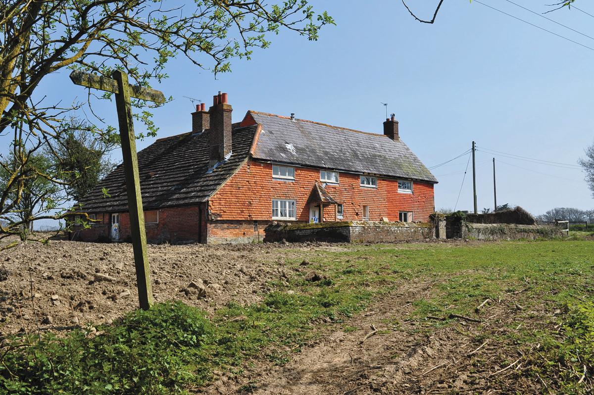
Cross the road (B2116) with care, turn right along the pavement for 100 yards and then turn left through a metal gate just before Dunstan’s Farm.
3 - Climb beside a paddock, cross a stile, continue on an enclosed path to a three-step stile and then descend across a field to a four-way junction and path sign on Reed’s Lane, an age-old trackway.
Take neither side turning but head north in a tapering meadow and make for the top corner, entering a copse and climbing to a field edge.
The way ahead, across the field, is on a faintly trodden path, keeping right of a line of three oak trees and then going down a slope to a crossing track, hedge opening and four-way sign. Keep direction in the next field, on a footpath that has not been reinstated, towards an opposite copse and there turn right up the field edge for 200 yards.
Take a right turn (there is an obscured sign in the hedgerow on the left) along the field edge towards the isolated, typically Wealden, farm cottage of Mockfords. (A more direct route from the earlier four-way sign is difficult to identify.)
4 - From a four-way sign do not go ahead across the front of the cottage but climb left, for about 50 yards, beside the boundary fence of the cottage garden, to a fence corner and another open field. Head directly across the field to a marker post, set between two sturdy oak trees, and continue ahead in the next field section to a hedgerow stile crossing.
In a paddock, cross to the far right corner, passing through a metal gate to arrive beside a three-way path sign and a farm manure storage enclosure ahead. Cross the field along the left hedgeline to the left corner and there turn right along the fenceline for about 100 yards, to go left through a bridle gate. The tower of the church in Cowfold is now in view.
Descend on an enclosed path for about 200 yards, go through a bridle gate on the right and turn left down the field edge to pass through a metal gate. Turn half-right across the next field, heading for a footbridge among a stand of trees.
5 - Cross the bridge, climb a bank and head for the far right corner of the next section of field, towards Gervaise Cottage.
Cross a stile in the far right corner of the field and follow an enclosed path to the right of the cottage and then up the left edge of a field. At the corner of the field, turn right, soon passing a pond, and continue to the corner beside woodland. Cross a stile, walk along the next field edge to a plank bridge and pass through a metal kissing gate.
Turn left up the next section of path, turning right when beside a school, and in 250 yards pass through a gate into the churchyard of St Peter’s at Cowfold. Go to the left of the church, following the path that leads down to a lychgate and the busy road junction at Cowfold.
This stage of our northward journey is now over and in the next walk we head into the early undulations of the High Weald.
For buses, turn right and walk down the A281, Henfield road, to the bus stop a few yards beyond the village hall.
Distance/Time: Six and a quarter miles, taking three hours
By Car: Parking and drop-off in Henfield High Street or car park (signed), alternative drop-off is at Cat and Canary pub in Upper Station Road, reduces walk distance by three quarters of a mile. Pick-up beside Cowfold recreation ground car park. Start point grid ref: TQ215160
By Public Transport: Stagecoach no 17 bus from Horsham and Brighton stops in Henfield High Street, close to Post Office. All of the walks on this south/north traverse can be accessed by public transport. Travel details from www.traveline.info, call 0871 200 2233
What’s underfoot: Mainly level walking on footpaths and bridleways, just a few slopes, stiles and gates. Possible with a baby backpack; not possible with an off-road baby buggy.
Thirsty Work: Pubs and shops at Henfield and Cowfold
So you don’t get lost: OS Explorer maps 122 and 134, plus a compass for general direction
Click here for a full-sized map of the Henfield to Cowfold walk


Comments: Our rules
We want our comments to be a lively and valuable part of our community - a place where readers can debate and engage with the most important local issues. The ability to comment on our stories is a privilege, not a right, however, and that privilege may be withdrawn if it is abused or misused.
Please report any comments that break our rules.
Read the rules here