
1 - If coming by bus, go to the Fire Station at the western end of the High Street, then up Mill Road on the left of the Fire Station towards the car park. If coming by car, turn right at the car park exit into Mill Road.
At the T-junction, turn right into Sheepsetting Lane, past the primary school on the right and the Community Centre on the left. On reaching the main road (A267), continue along the footway to the right, crossing over the top of Pages Hill.
The Heathfield TV transmitter mast is visible from here and many other places on the walk. This was one of the last to be upgraded for the digital switchover in 2012 and serves most of East Sussex.
Nearing the junction with the A265 at the bottom of the hill, cross the road with great care as soon as there is a footway on the opposite side. Hidden among the trees here is St Bartholomew’s Church, known locally as St Bart’s, which was built in 1863.
Continue direction for about 500 yards along the footway towards Cross-in-Hand.
2 - Just before the Tennis Club grounds on the left, cross the road with great care to go along a tarmac track opposite. Although there is a Private Road sign, there is also a hidden bridleway plinth near the 40mph sign on the right to confirm that this is a right-of-way.
Follow the bridleway and, in 400 yards, pass very close by the TV mast with a smaller communications mast nearby. In a further 250 yards, at an English Woodlands sign, follow the track as it bears around to the right.
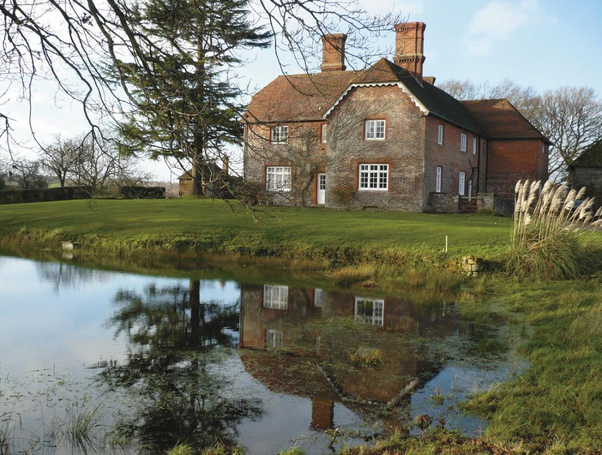
Continue for nearly another mile through woodland, then with fields on one side, and then on both sides. After passing ponds on the left, come to Herrings Farmhouse on the left.
3 - Turn right here and go down across a field to the corner of another field. Continue through a gateway by a waymark. Then, using the white-painted house on the hillside ahead as a guide, aim for another waymark on the edge of woodland.
Follow the path in the wood to cross a footbridge and then continue uphill to cross a track. In a short distance, by a waymark on a tree, bear left on the path leading over another footbridge.
In a few paces, go over a stile and then turn right as indicated by a fingerpost, uphill through a field. Go to the right of Orchard House, the white-painted house seen earlier.
The officially-diverted footpath now goes through a field gate on the right. Follow the wooden fence as it goes around to the left uphill to a fingerpost by the main entrance to the house.
Turn right to cross an old railway bridge. Below is the trackbed of the old Cuckoo Line railway from Heathfield to Tunbridge Wells, which closed in the 1960s. It was so-called because of the legend that the first cuckoo of spring is released at the annual Heffle (Heathfield) Cuckoo Fair in April.
Continue uphill along the track, with views on the left towards Mayfield, until coming to Marklye Farm. Notice the restoration work being done to the old buildings here.
4 - Now turn right along Marklye Lane for just over half a mile. Views to the left from here are towards Broad Oak and Burwash Common.
On reaching traffic lights just before the main road, turn right along a minor road with the interesting name of Mutton Hall Lane.
Go to the end and, immediately before the entrance, drive to the last house, turn left on a footpath down through a twitten between board fences. This leads to a driveway down to the main road (A265), known at this point as Mutton Hall Hill.
5 - Cross the road with care to the footway opposite and turn right. Continue across the top of Marshlands Lane into the High Street.
This is the modern part of Heathfield which grew with the coming of the railway (now closed) in the 19th century. The original settlement of Old Heathfield is one and a half miles to the south-east.
For a quick end to the walk, continue on through the High Street to return to the bus stops and/or car park. There are wide pavements and a good variety of shops to browse or visit on the way.
Otherwise, turn left at the mini roundabout, down Station Road and then right at the next junction by Sainsburys. Continue to the bottom of the hill to see the old station building on the left immediately before the old railway bridge.
To complete the walk, go up the fairly steep footpath opposite, which goes over the old railway tunnel. Then at the High Street, turn left to return to the Fire Station.
6 - For an optional extra, cross to the Co-op car park opposite. Go to the farther bottom corner where a sign indicates the way into the Millennium Green. As the name implies, this was created at the turn of the century, and is mostly woodland covering a wide variety of habitats along the route of the former railway line.
Enjoy a wander through this large public open space. The distance covered is entirely optional, as when desired, retrace the route back to the High Street.
- Distance/Time: Four and three quarter miles/two and a quarter hours; allow at least an extra 15 minutes for the optional extra at the finish
- By Car: Mill Road car park (free) off High Street (western end), Heathfield
- By Public Transport: Heathfield is well served by buses from all directions; alight at western end of High Street, near the Fire Station. Timetable information from Traveline, call 0871 2002233 or visit www.traveline.info
- What’s underfoot: A mixture of roadside and surfaced tracks, also field and woodland paths which are likely to be muddy at this time of year. Very few stiles
- Thirsty Work: The Prince Of Wales pub, Station Road. Also cafes and restaurants in High Street, Heathfield
- So you don’t get lost: OS Explorer Map 135
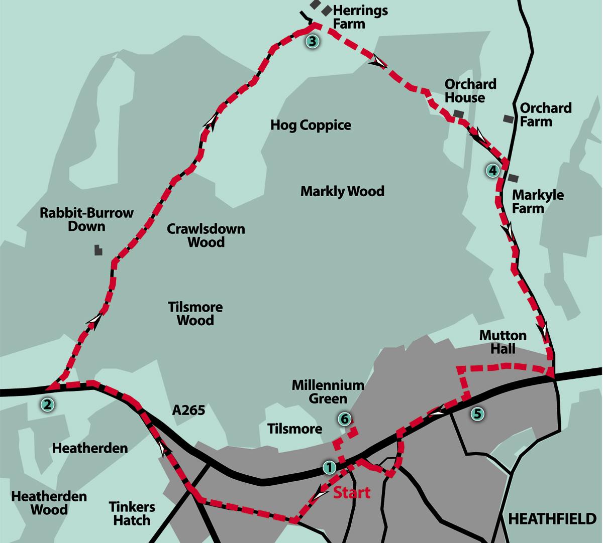
Click here for a full-sized map of the Heathfield circular walk


Comments: Our rules
We want our comments to be a lively and valuable part of our community - a place where readers can debate and engage with the most important local issues. The ability to comment on our stories is a privilege, not a right, however, and that privilege may be withdrawn if it is abused or misused.
Please report any comments that break our rules.
Read the rules here