
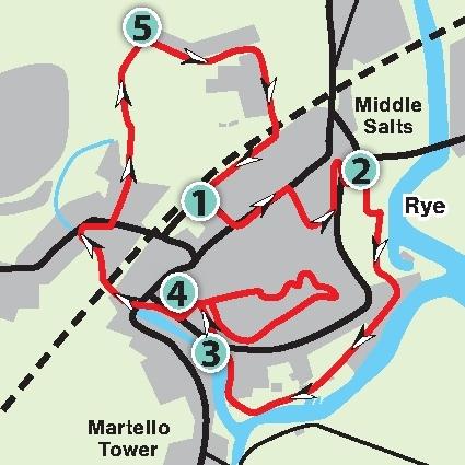
[1] From the Rail Station exit, go straight ahead up Station Approach past the bus stops. Turn left by the Cinque Ports Arms and past the Baptist Church and Police Station, both on the left. At a mini-roundabout, cross to the right and go up the cobbled Conduit Hill by a red telephone kiosk.
At the top, turn left and, where the road bears left, go across to the right to see a topograph with a view across the River Rother and East Guldeford Level. Continue downhill on the footway to the Landgate built in 1329 (see plaque for more details) before turning back to Tower Forge and go down a steep slope with steps.
[2] Cross the road at traffic-light controlled crossing and go down a tarmac path to the left of the bowling green. There are toilets here, if required. Follow the path around through the children’s play area; then turn left uphill and turn right. There are seats and picnic tables on the right.
In about 200 yards, cross an access road and continue direction between industrial buildings along a tarmac roadway. On coming to Rock Channel House, go along the footpath to the right. Continue direction along a paved area with an anchor on the right.
Go along the roadway, using the raised path on the left for a better view of boats moored on the River Brede. Follow the roadway around to the right past an unusual wooden-clad building.
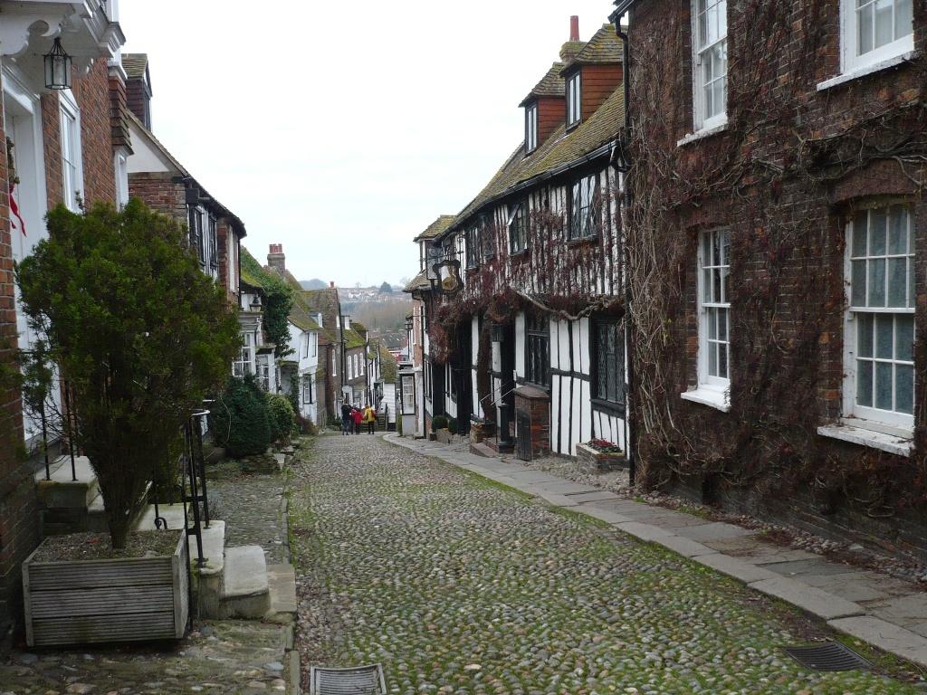
[3] At the main road (A259) cross with care by a cobble-stone island and turn left along the road to the right of an anchor. In about 150 yards, just past a red telephone kiosk, turn right up the cobbled Mermaid Street. In a few paces, turn right up another cobbled street.
At the top, pass the Hope Anchor Hotel on the left, bearing left along Watchbell Street. Immediately past the churchyard, turn right to visit Ypres Tower and see the cannons and stacks of cannonballs.
Turn back and enter the churchyard by the war memorial and follow the path around to the right. At the main entrance, step back a few paces and look up at the church tower to see the 16th century clock and Quarter Boys which were added in the 18th century.
Follow the path around to the right, bearing right along the cobbled West Street and then, in a few paces, turn left to go down the full length of Mermaid Street. At the bottom, continue direction to the main road with Rye Heritage Centre on the right and toilets on the left.
[4] Turn right and go over the zebra crossing, turn right and over the next zebra crossing. Continue down a footpath by a fingerpost and, with the windmill ahead, cross the railway line with care through hand-gates either side. Follow the tarmac path alongside the River Tillingham.
At the road, turn right and, just past Ferry Road Health Centre, cross the road to go along Tillingham Avenue. In about 150 yards, continue direction on the raised path away from the houses. Follow the tarmac path for about 400 yards, alongside the river again, ignoring a field path on the left until coming to a field-gate on the left leading to Rolvendene Farm.
[5] Turn right along Love Lane for about 300 yards and, at the junction with Deadmans Lane, turn right along The Grove. Go over the railway line and, immediately past the crossing, turn right through the Station car park to the Rail Station and bus stops.


Comments: Our rules
We want our comments to be a lively and valuable part of our community - a place where readers can debate and engage with the most important local issues. The ability to comment on our stories is a privilege, not a right, however, and that privilege may be withdrawn if it is abused or misused.
Please report any comments that break our rules.
Read the rules here