

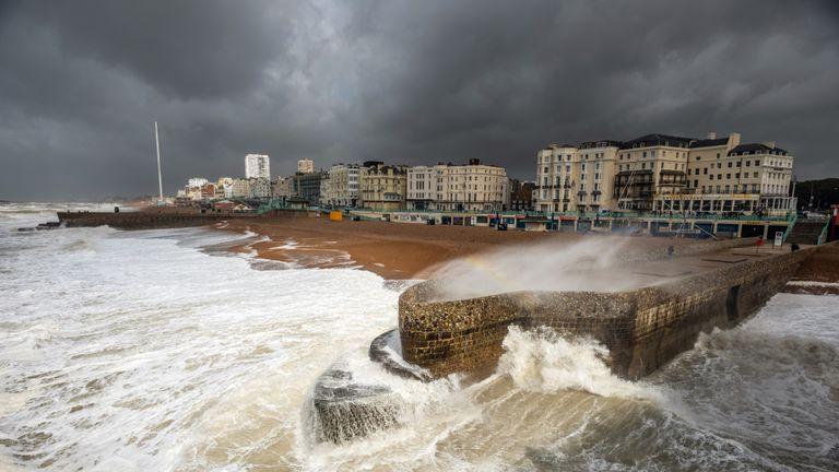
HEAVY downpours are set to hit the county this week, as we face what could be one of the wettest Augusts on record.
Severe thunderstorm warnings were in place for Sussex on Monday, with the chance of flooding, travel disruption and power cuts, the Met Office warned.
Regular heavy downpours could continue into the last week of the month - with potentially enough rainfall to make it the wettest August on record.
The previous high, in 1912, saw an average of 167.6mm across the country.
Met Office forecaster Becky Mitchell said: “It’s been pretty wet and it looks like it’s going to stay that way until the last week of August. Only then are we expecting to see a break in the clouds.”
Fellow meteorologist Bonnie Diamond said: "This week there's going to be a fresher feel, winds from the north bringing cooler temperatures than we've seen in a while.
"It's going to be an unsettled week with periods of low pressure bringing rain and wind at times, especially on Wednesday and Friday. We're looking at top temperatures in the high teens."
After a more settled day on Tuesday, the wet and windy weather will then return midweek, with more widespread showers.
Ms Diamond explained: "Overnight Tuesday into Wednesday, an area of low pressure is bringing a band of rain across the whole country.
"Wednesday is going to be a pretty wet day."
The bleak outlook follows a weekend of unseasonable heavy rain and 55mph gales.


Comments: Our rules
We want our comments to be a lively and valuable part of our community - a place where readers can debate and engage with the most important local issues. The ability to comment on our stories is a privilege, not a right, however, and that privilege may be withdrawn if it is abused or misused.
Please report any comments that break our rules.
Read the rules hereLast Updated:
Report this comment Cancel