

LARGE parts of Sussex will fall below sea level by 2050, according to new predictions.
A study in the journal Nature Communications claims tens of millions more people are claimed to be at risk of flooding if we don’t start urgently cutting our use of fossil fuels and emitting green house gases.
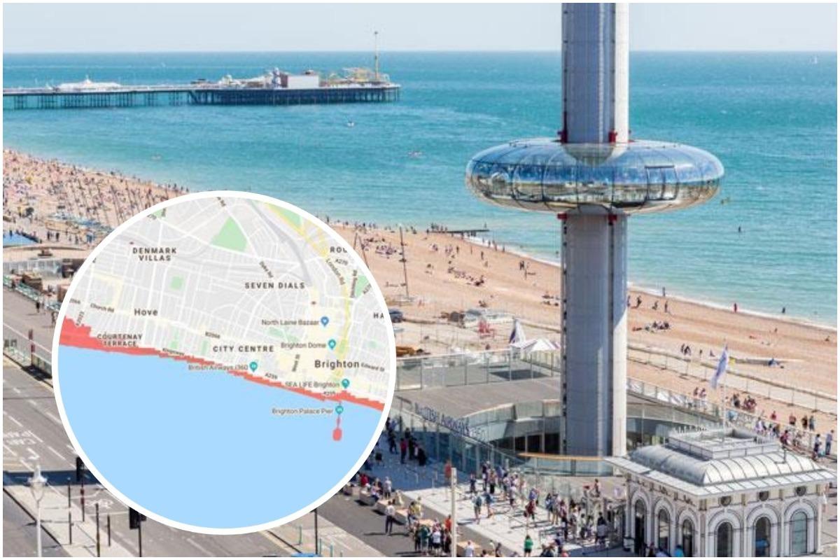
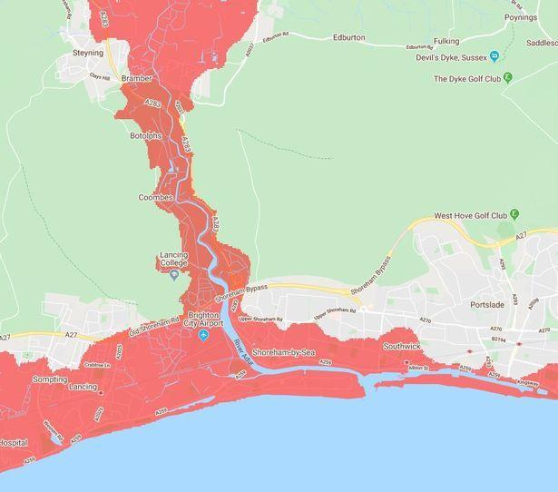
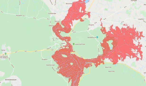
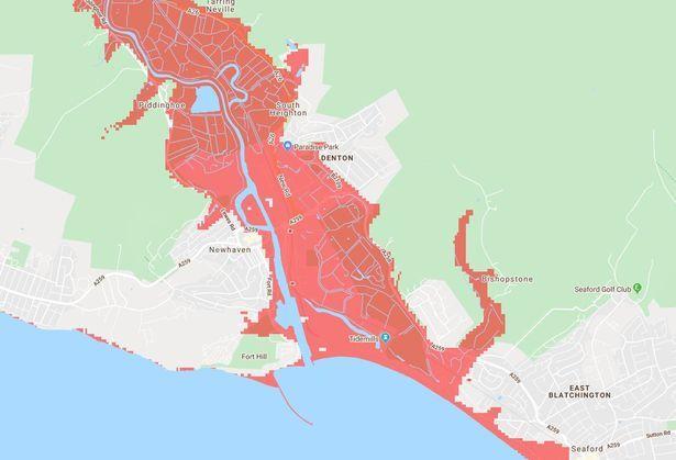
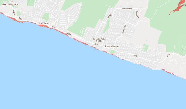
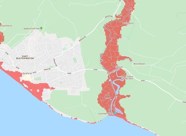
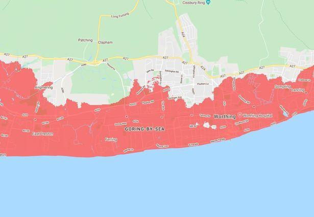
The latest scientific data has shown the scale of the issues coastal Sussex could face due to sea levels rising.
Detailed maps have been produced so you can see how your street could be affected.
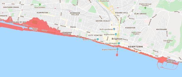
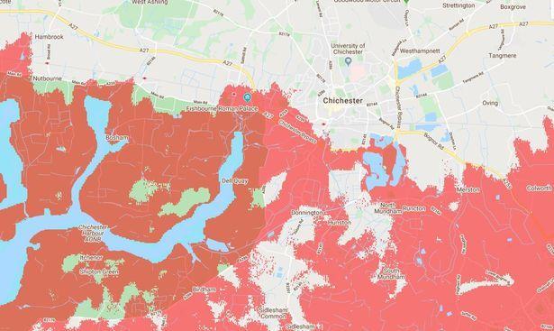
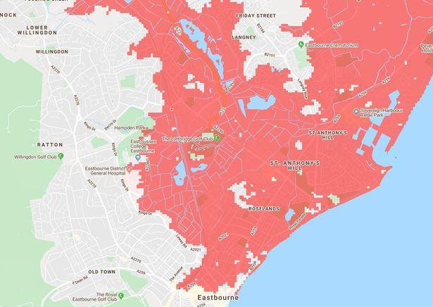
The maps above show the parts of the county that could be under water within 30 years.
This means that children born today will likely live to see this happen.
There are three main reasons why the sea rises in hotter temperatures.
Huge ice sheets at the poles melt faster than they form from snowfall loading more water around the earth, ice at high altitude melts at higher points and as with all things, heat makes the oceans expand.
Experts say causes of global warming by humans include burning fossil fuels - coal, gas and oil - factory farming and increasing livestock production and deforestation.
Although these will be gradual changes that could take some years before they reach the levels shown on the map, once they are noticeable it will be too late to stop them.
Climate Central also predicts huge parts of Sussex will be hit by annual coastal floods in the next 30 years.
The map shows the majority of the coastline will be underwater, with almost the entire seafront from Rye to West Wittering submerged.
The images are based on predictions if we make no cuts to emissions.


Comments: Our rules
We want our comments to be a lively and valuable part of our community - a place where readers can debate and engage with the most important local issues. The ability to comment on our stories is a privilege, not a right, however, and that privilege may be withdrawn if it is abused or misused.
Please report any comments that break our rules.
Read the rules hereLast Updated:
Report this comment Cancel