
STEVE Kisko ventures up onto the South Downs north of Hangleton to visit a new public bridleway that has been created linking Benfield Hill with the dismantled Devil’s Dyke railway.
This new route is seen as a ‘missing link’ in the rights of way network and will act as an important wildlife corridor improving biodiversity
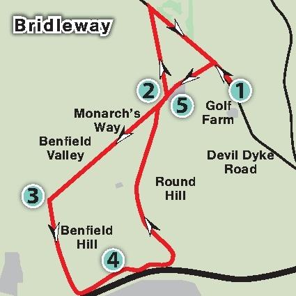
1. Start in the car park on Devil’s Dyke Road just north of Golf Farm and very close to the signposted boundary between Brighton & Hove and West Sussex. Exit to the north, the same end as the vehicle entrance, onto a narrow path by bushes which takes you onto a permissive bridleway running parallel to the road. Continue ahead on it, aiming north-west. In 200 yards turn left to the road and cross over it by bus stops to follow a public footpath that runs along the access road to Brighton & Hove Golf Club. You can start here if you came by bus. In 400 yards continue ahead past the golf clubhouse.
2. Just a bit further on, ignore a bridleway to the left across the gold course and to the right up a tarmac track (although you will be taking the latter on the return). Continue on down and in a further 100 yards do not turn left on the tarmac path (again, will you return via this) but walk ahead and go through wooden posts into an arable field. Follow the left fence line as the footpath goes downhill beside the course of West Hove Golf Club. You have now joined The Monarch’s Way (TMW), a long-distance trail and are now walking through Benfield Valley. After half a mile you reach the bottom and pass over a wooden barrier. Do not take a restricted byway over to the left but keep right and continue on the footpath as it now goes uphill fenced-in between fields. After about 375 yards you reach a summit.
3. Turn left through a gate and onto another footpath fenced-in between fields. You leave TMW here. This takes you over Benfield Hill. In 400 yards you reach bushes and enter Benfield Hill local nature reserve. Follow the footpath ahead as it gives way to open grassland. You gradually head downwards and in 300 yards go around the side of a gate to reach the entrance lane to West Hove Golf Club. Cross over and take a footpath opposite which arcs down and around to the left. Further on, do not cross the bridge on the right that goes over the A27 but continue on downhill.
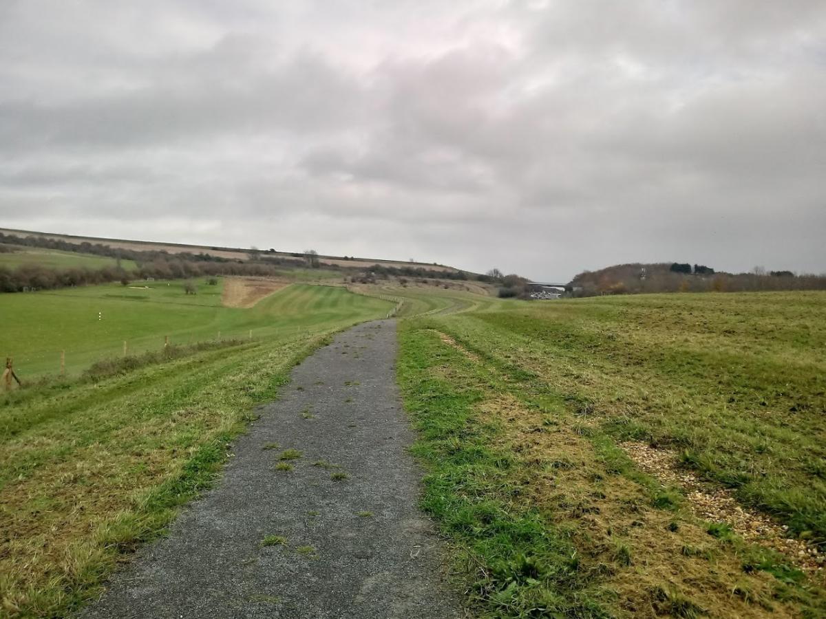
4. In 150 yards where the footpath starts to bend to the left to re-join the golf course road go through a new gate on the right – this is where you join the newly-created public bridleway (officially termed ‘BW H22’). This route runs for nearly half a mile on a firm gravel track through open grassland with the A27 on the right and a golf driving range on the left. This new route was created to provide an important access link in the area. Towards the end is a short climb to the left. Go through a gate onto a concrete footpath and turn left. You are now on the course of a disused railway line. Simply stay on this track for nearly a mile until you reach point 2 again.
5. Turn right onto the footpath up towards the clubhouse. If you wish to cut it short here, stay on this road back to Devil’s Dyke Road, cross over and turn right onto the permissive bridleway that leads back to the car park. Or after 100 yards turn left onto the bridleway seen earlier which is on a firm concrete surface running in a straight direction between fields. In just under half a mile reach Devil’s Dyke Road by passing through a gap to the left of a gate. Cross over the road and turn right onto the permissive bridleway that runs parallel with the road which after half a mile returns to the car park. 200 yards before the car park you will pass the entrance of the road to the clubhouse on the right where you can also find the bus stops you passed near the start.


Comments: Our rules
We want our comments to be a lively and valuable part of our community - a place where readers can debate and engage with the most important local issues. The ability to comment on our stories is a privilege, not a right, however, and that privilege may be withdrawn if it is abused or misused.
Please report any comments that break our rules.
Read the rules hereLast Updated:
Report this comment Cancel