

Starting from Mayfield, this substantial and fairly strenuous walk by Ben Perkins dips from a Wealden ridge to cross several streams, including the infant River Rother, not far from its source. On the return route, links along quiet lanes allow us to enjoy several paths new to The Argus walks.
1 - From the entrance to Mayfield village car park, turn left along a lane. After a little over 100 yards, double back to the left along Vale Road. Just past a white weather-boarded cottage called Chimneys on the right, turn right along a narrow path between gardens, then along a left field-edge and down through an area of tree planting.
Cross a stream in a wooded dip, climb steeply to a stile and follow a left field-edge.
In the field corner cross a drive, climb a bank to the right of a gate (not through the gate), and follow a high left-hand fence beside two fields and on to join a road.
2 - Turn right and, after about 300 yards, just past a 30mph speed restriction sign, turn left along a short path down through trees to join a drive and turn left. Cross a high bridge over the old railway and the bear left through a gate.
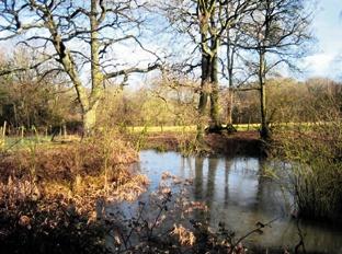
Just past the last building of a stable complex on your right, go right for 40 yards to a stile, drop downhill along the left edge of two fields and cross a footbridge in a wooded dip, taking you across the infant River Rother.
Climb along a left field-edge, go through a gate and veer very slightly left across the next field, converging on the left boundary where you can join and go ahead along a concrete farm track. Where the track divides, fork right to follow it, unfenced across a field to join a lane. Turn left.
3 - At a road junction, turn right along Leeds Lane. After a little over half a mile, just past the entrance to a bungalow on your right, fork right along a trodden path, soon between tree-lined banks, which takes you through to the A267 at Five Ashes.
If in need of refreshment, the Five Ashes Inn is a few minutes walk to the left but our walk continues along Criers Lane, almost opposite. At a road junction, turn left, still along Criers Lane.
After another half a mile, turn right along the drive to Broadreed Farm. At the farm go straight ahead between the buildings and on along an unmade track. Where this track ends, go through a gate and bear right to follow a meandering right field-edge, gently down to a stile.
Go forward for a few yards to a second stile, and down to cross an unbridged but easily-fordable stream in a dip. Climb a bank, cross rough ground to a stile and follow a right field-edge which finally skirts to the left of a house and garden to join a lane.
4 - Step into the start of the drive to Stocklands Farm, opposite, and immediately turn left through a narrow gate, hidden behind the hedge and head diagonally across the middle of a field, using a diverted footpath route, indicated only on the latest edition of the Explorer map. In the far corner, go through another gate, follow a right field-edge to a gateway and carry on along a clear woodland path.
Where the path divides, fork right down to cross a footbridge and immediately turn left along a clear path along the left edge of a paddock with a small stream on your left. Follow the stream until the main path bears right and climbs through a grove of trees.
Go through a gate and bear left along a drive. Where the drive bends right, cross a stile on your left and climb across a field diverging only very slightly from the right field-edge, to join a lane over a stile, hidden behind trees, a few yards to the left of the field corner. Turn right.
5 - After a quarter of a mile, just short of a house called Little Ease Farm on the right, turn right along a drive and, after about 100 yards, turn right through a gap to the left of a high, locked, iron gate and follow another drive through a derelict area.
Just short of a junction, turn left across rubble-strewn rough ground. Out into a field, go ahead, joining and following a hedge projecting towards you, keeping it on your right.
In the corner descend to cross a footbridge and follow waymarks right and left, up through a wood, on along a fenced path, through two gates and downhill along a left field-edge.
In the field corner go left through a swing gate and along a right field-edge.
After 80 yards, go right through a gap, diagonally down across the middle of a field to a footbridge, and up along a right field-edge.
In the field corner cross a stile, climb beside a left-hand fence to another stile and continue along the left edge of a garden and along a house drive to join a road.
6 - Turn left and shortly, fork right, signed to Argos Hill. After about 100 yards, go right over a stile, forward to go over wood railings in a crossing fence, then down across a field, through a gap and along a left field-edge. Beyond a gate, veer slightly right to another gap and head squarely across a field to join and follow a protruding right-hand hedge. Go over a stile in the corner and left around two sides of a paddock to a stile and along the left edge of a garden to join a lane.
7 - Turn left. After two-thirds of mile, cross the Mayfield bypass, follow the zigzag cycle path opposite.
At a road junction turn left for another half-mile into Mayfield.
* Distance/Time: Seven and three quarter miles taking four hours.
* By Car: Start from Mayfield where the village car park is rather unobvious, signed south from the High Street along a narrow lane at GR 588270.
* By Public Transport: There is an hourly weekday bus service from Heathfield or Tunbridge Wells to Mayfield.
* What’s underfoot: This is a fairly up and down walk, sometimes along little used and only partially signed paths where careful navigation is required. Particular care is need through the derelict area after point five.
* Thirsty Work: Pubs at Mayfield and at Five Ashes, about 200 yards off the described route.
* So you don’t get lost: OS Explorer 135


Comments: Our rules
We want our comments to be a lively and valuable part of our community - a place where readers can debate and engage with the most important local issues. The ability to comment on our stories is a privilege, not a right, however, and that privilege may be withdrawn if it is abused or misused.
Please report any comments that break our rules.
Read the rules here