
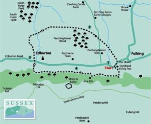
1 - From the lay-by, west of that famous pub, pass the spring outlet, turning left up The Street. At the top of the hill cross to the John Ruskin water fountain memorial. Take a few paces right, passing through a gate on to the village green. Walk to the right corner; pass through a gate to a field-edge. Follow the trodden path, half-left, crossing a mid-fence stile and continuing half-right to the field corner, on to a track. Go left to a path sign and take a half-right line across a field to a concrete track.
From the track cross a stile in the left fence, 50 yards right of a pylon, continuing half-right to the field corner and crossing a stile and bridge beside Perching Hovel Wood.
2 - Turn left beside the wood, coming to a bridge and stile; continue ahead along the next left field-edge. At the field boundary cross a stile and bridge, keeping direction on a bridleway to a track and four-way junction. Take a few paces left, climb a low bank on the right, follow the left hedgeline to a field corner. Go left through hedgerow, cross a bridge, turning right to arrive beside a cottage. Walk along the left fence for 150 yards, going left through hedgerow. Do not take a right turn but continue up the left edge, going left through hedgerow in 150 yards, passing an industrial unit and turning right along a driveway.
3 - At Edburton Road take a few paces left, crossing to a public footpath on a surfaced drive leading to a parking area, near commercial buildings. Climb the bank, right, on slippery steps, beside a fence, turning left and crossing on to open access land. In 20 yards take a trodden, unsigned permissive path, going left along the edge of the woodland. The northern scarp face of the Downs looms to the right, as the path follows the rise and fall of the coombes.
In a quarter of a mile a bridleway joins from the left, beside a copse – keep direction ahead. Follow the left hedgeline for a further quarter of a mile, with sloping meadow to the right, to join a footpath coming from the left. Divert right, crossing a stile behind a cattle trough.
4 - Climb left up a bank, continuing along the hillside, taking no side turnings, and descending through scrub to a track.
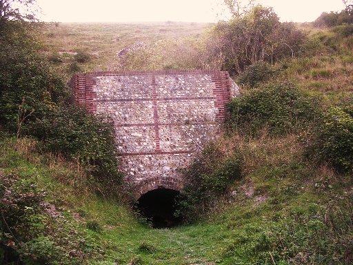
Go right for 50 yards taking a signed left turning up a bank. Note further up the track the reconstructed flint-built lime-burning kiln, evidence of earlier local industry. Keep direction for one third of a mile (take no side turnings) to a three-way junction, joining a wide descending path. Turn full-left on the descending path, cross a stile in 100 yards and continue for 200 yards, diverting half-left, through hedgerow, to the car park beside the Shepherd And Dog pub.
* Distance/Time: Three miles, taking one and a half hours.
* By Car: Fulking is midway between the A23 and A2036 roads on the minor road that runs beneath the north slope of the South Downs, one mile west of Poynings. Lay-by parking west of the village pub. Start point grid ref TQ246113.
* By Public Transport: Travel details from www.traveline.info, phone 0871 2002233. No direct bus service to Fulking.
* What’s underfoot: Mainly level walking below the Downs, paths generally good, bridges slippery when wet, one short, steep climb. Possible with a baby backpack, care required on steep slopes; not possible with a baby buggy.
* Thirsty Work: The Shepherd And Dog pub in Fulking.
* So you don’t get lost: OS Explorer map 122, plus a compass for general direction.


Comments: Our rules
We want our comments to be a lively and valuable part of our community - a place where readers can debate and engage with the most important local issues. The ability to comment on our stories is a privilege, not a right, however, and that privilege may be withdrawn if it is abused or misused.
Please report any comments that break our rules.
Read the rules here